


 Greg Cocks
 Earth's Storage Of Water In Soil, Lakes And Rivers Is Dwindling - And It's Especially Bad For Farming
--
https://phys.org/news/2025-03-earth-storage-soil-lakes-rivers.html <-- shared technical article
--
https://doi.org/10.1126/science.adq6529 <-- shared paper
--
#water #hydrology #waterresources #global #management #watersecurity #soil #lake #river #snow #groundwater #agriculture #sealevelerise #SLR #climatechange #farming #overuse #waste #moisture #soilmoisture #ecology #ecosystems #storage #model #modeling #spatialanalysis #spatiotemporal #rainfall #drought #consistency #wateruse #crop #plant #vegetation #irrigation #foodsecurity #evapotranspiration #ET #surfacewater #flux #GIS #spatial #mapping #remotesensing #earthobservation #waterstorage #depletion


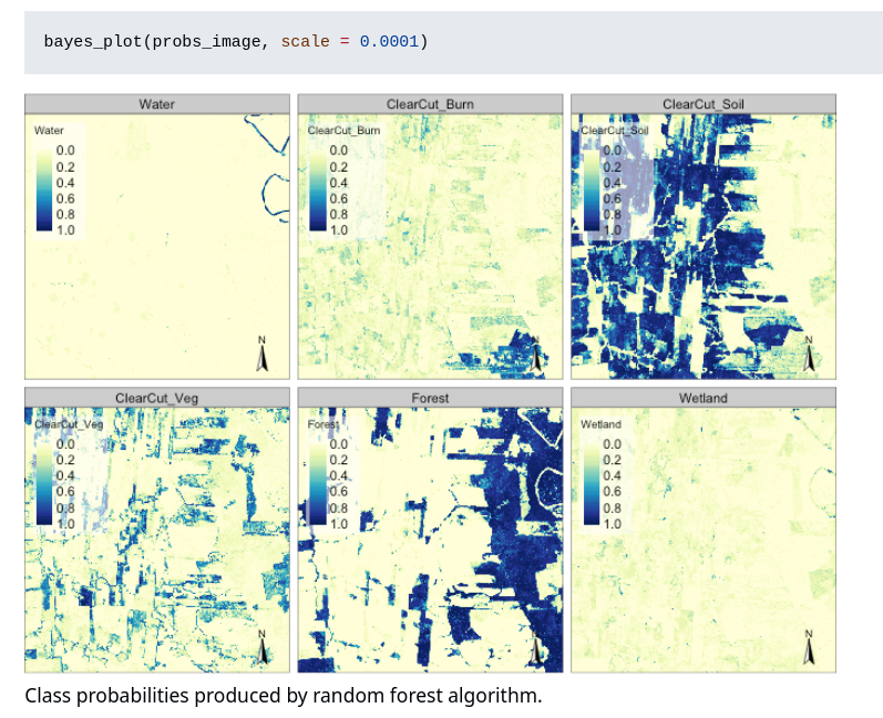
/not ice (white). Further ice subclasses were aøso determined (not shown here)")


 𝗘𝗻𝗦𝗨𝗣 𝗣𝗿𝗼𝗷𝗲𝗰𝘁 𝗠𝗲𝗲𝘁𝗶𝗻𝗴: Greetings from
 Learn more: